National Hurricane Center 11am update: Key Points
Here are the key points from the National Hurricane Center’s 11a.m. update on Hurricane Erin.
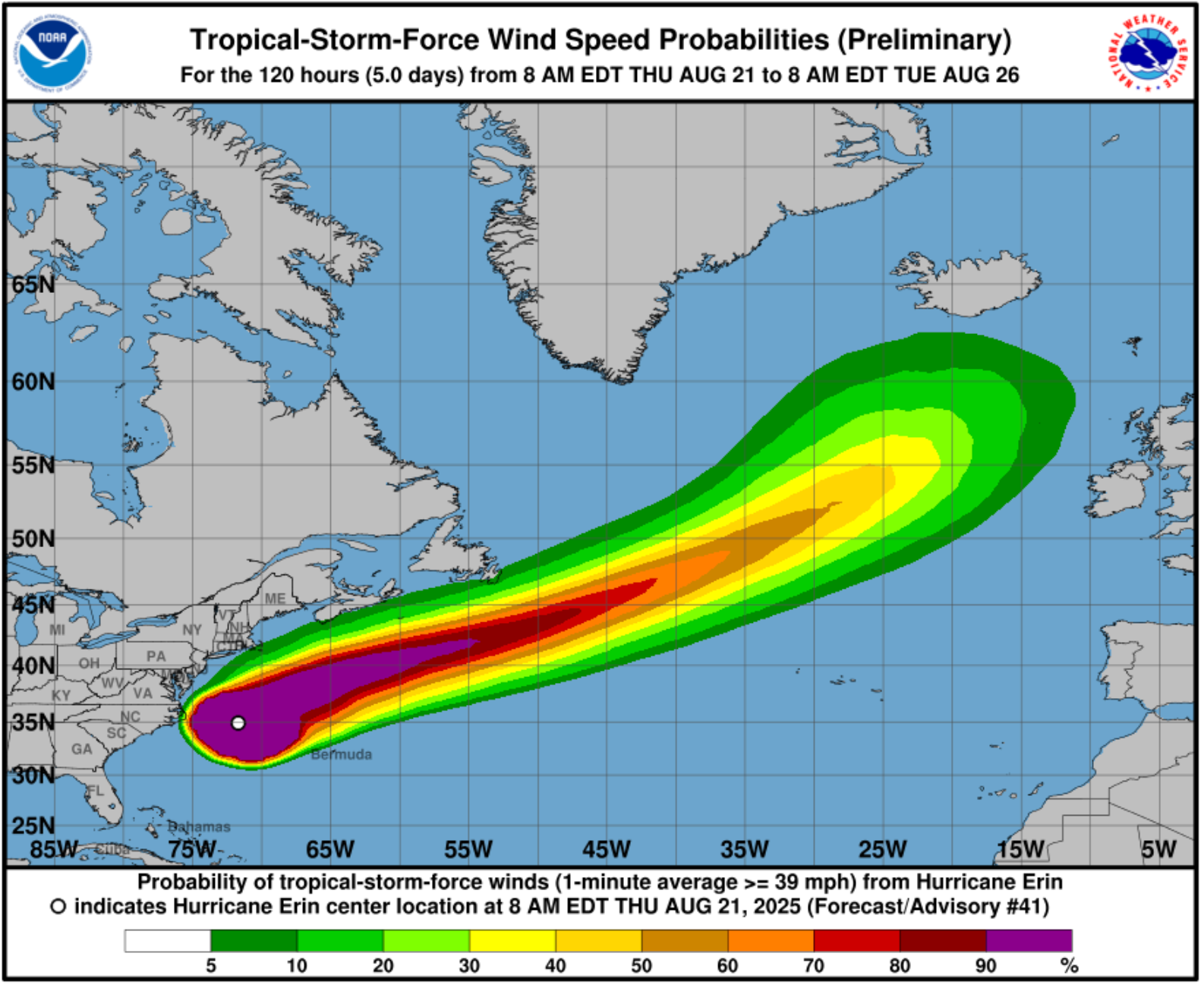
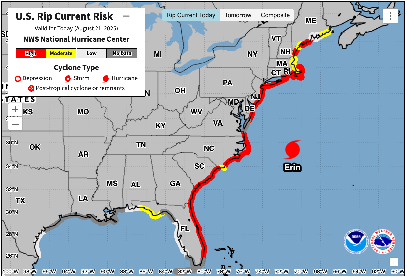
- Erin will continue to produce life-threatening surf and rip currents along the beaches of the Bahamas, much of the east coast of the U.S., Bermuda, and Atlantic Canada during the next several days. Beachgoers in those areas should follow advice from lifeguards, local authorities, and beach warning flags.
- Storm surge flooding and tropical storm conditions will continue on the North Carolina Outer Banks today. The storm surge will be accompanied by large waves, leading to significant beach erosion and overwash, making some roads impassible.
- Tropical storm conditions are expected today along the Virginia coast. Wind gusts to tropical storm force are likely along portions of the remainder of the U.S. Mid-Atlantic and southern New England coasts today through early Friday.
- Tropical storm conditions are possible on Bermuda this afternoon through early Friday. Gusts to gale force are possible along the coast of Nova Scotia on Friday and the Avalon Peninsula of Newfoundland on Saturday.
Mike Bedigan21 August 2025 16:00
Erin is still a ‘sprawling’ hurricane
Despite no longer being a Category 3 storm, Hurricane Erin “remains a sprawling hurricane,” per the National Hurricane Center’s 11 a.m. briefing.
Erin’s tropical-storm-force winds, the measurement for how far-reaching a storm is, extend nearly 500 nautical miles across.
When compared with weather systems around the same intensity and in similar locations over the past couple of decades, Erin registers within the 90th percentile in size.
As of the latest update, Erin’s winds are sustained at around 100 mph in certain areas.
Mike Bedigan21 August 2025 17:42
Watch: Storm surge, strong winds hit MD, VA & DE
Mike Bedigan21 August 2025 17:23
Coastal flooding warnings in affect for NYC
Coastal flood warnings were put in place Thursday for the Jersey Shore and New York City’s south-facing beaches.
Most beaches were previously closed to swimming for the next few dats, with officials urging people to stay out of the water.
Authorities noted that the risk of flooding increases Thursday into Friday, when high waves coincide with high tide.
Mike Bedigan21 August 2025 17:03
Hurricane Erin windspeeds to exceed 100 mph in parts Thursday
Take a look at Thursday’s windspeed projections for Hurricane Erin, which predict that in parts near to the coast, gust may exceed 90 mph and approach triple digits.

Mike Bedigan21 August 2025 16:47
What is a rip current?
The National Hurricane Center has warned that there is a high risk of rip currents along the majority of the East Coast on Thursday.
According to NOAA, rip currents are powerful, narrow channels of fast-moving water that are prevalent along the East, Gulf, and West coasts of the U.S., as well as along the shores of the Great Lakes.
Rip currents can move at speeds of up to eight feet per second, which is faster than an Olympic swimmer.
Swimmers who panic, often try to counter a rip current by swimming straight back to shore, though this can put them at risk of drowning due to fatigue.
Per NOAA, lifeguards rescue tens of thousands of people from rip currents in the U.S. every year, but it is estimated that 100 people are killed by rip currents annually.
Rip currents are often confused with rip tides.
A rip tide is a specific type of current associated with the swift movement of tidal water through inlets and the mouths of estuaries, embayments, and harbors.
Mike Bedigan21 August 2025 16:37


