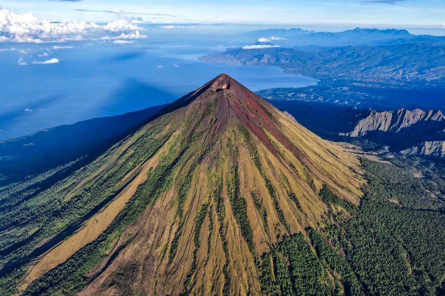
Mount Inerie is the tallest volcano on the island of Flores, and it might just be one of the most symmetrical volcanoes in the world. At sunrise, it casts a perfect shadow like a natural pyramid.
I hiked Inerie recently and it was an awesome experience. There’s plenty of challenge, but anyone who’s a fit hiker can do it.
I’d recommend hiring a local guide like I did, because the path to the top can be hard to follow, and people usually start in the dark in order to see sunrise on the summit.
This guide will explain how to hike Inerie, and everything you need to know before you go!
Quick Stats*
- Distance: 6.5 kilometers (4 mi) round trip
- Elevation Gain: 1,100 meters (3,600 ft)
- Max Altitude: 2,245 meters (7,365 ft)
- Duration: 5 – 7 hours
- Difficulty: Hard
*These are approximate stats and may vary depending on your route

The shadow during sunrise looks like a pyramid. Epic.
My Trekking Guide: Alfredo Sua
I did the Inerie hike with Alfredo Sua, a local guide from Bajawa, and I highly recommend going with him for your own hike.
He picked me up from Bajawa by motorbike and brought all the gear I might need for the hike: headlight, gloves, and walking stick.
He speaks good English and he’s very familiar with the route on Inerie, even when it looks confusing. We got to the top in time for sunrise and he waited for me happily while I flew the drone and took lots of photos.
His prices are competitive, and he asked for less than another guide in Bajawa that I had contacted earlier.
You can message Fredo by WhatsApp at +62 877-6825-1093.

Drone view of Mount Inerie and the surrounding coastline
Trailhead: How To Get There
Mount Inerie is located near the town of Bajawa, in central Flores.
Here’s a Google Maps pin for the starting location. It’s only a 30 minute drive from town, and if you hire a trekking guide they’ll usually pick you up from town and drop you off there afterwards.
Bajawa is a good base for the hike. It has plenty of hotels and restaurants, and its own little airport.
You can fly there from Labuan Bajo (the gateway to the Komodo islands), or do an overland road trip through Flores and hit this volcano along the way.
There are a bunch of cool things to see and do near Bajawa as well, so I’d recommend staying at least a couple days.

Sunrise at the summit

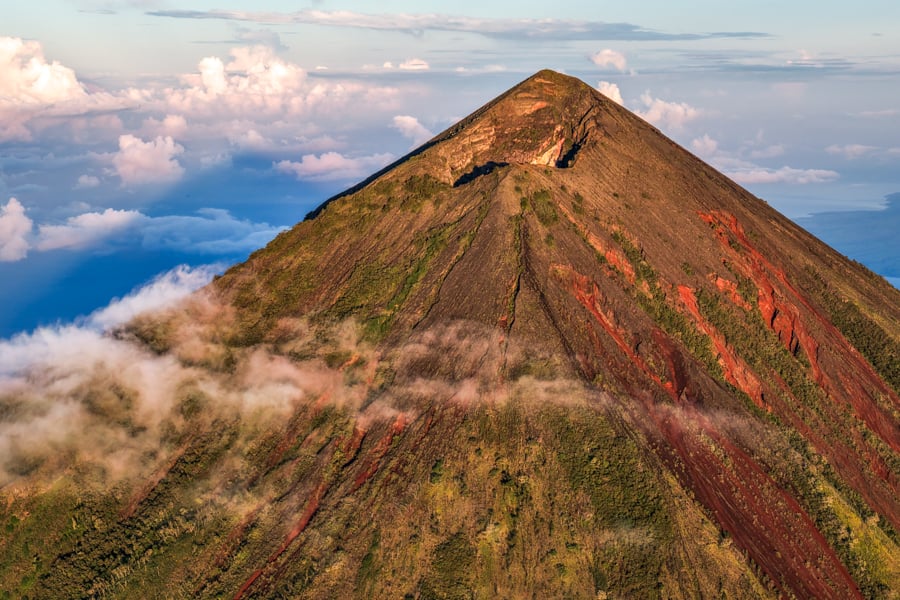
The awesome cone of Inerie in the clouds
What To Expect: Hiking Mount Inerie
The Inerie hike starts out pretty tame. For the first hour or so, you’re walking through a forest and savanna without much of an incline.
Things start to get steeper when you reach the volcanic rocks. It turns into scrambling, loose rocks, and occasionally deep ravines that you have to hike through or bypass with care. The path gets tricky to follow.
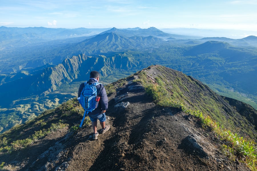
It continues like this until you reach the crater. At that point, you’re just 30 minutes from the summit. Keep going! It gets very windy near the top, but the rest of the trail is easy to follow.
We took about 3 hours and 15 minutes to reach the top, but we were moving a little on the slow side. I’d say 3 hours is average.
The summit has amazing views of the whole area. On a clear day, you can see Bajawa town, the Savu Sea, and the sun rising in the distance behind Mount Ebu Lobo, an active volcano that’s usually puffing out smoke.

Purple glow

Sunrise on top of Mount Inerie

Starting back from the summit
Going back, my guide gave me two options: we could go down the same way we came, or we could ‘surf’ down volcanic dirt and gravel in one of the ravines.
I decided to surf. It seemed like an easy choice at the time, but ultimately I’m not so sure it made things any easier.
My shoes kept filling with rocks and dirt, and we were falling all over the place trying to surf down the gravel. We had to take our shoes off several times just to get all the rocks out!
In any case, it was fun and it probably shaved some time off of our return hike. Going back took us about 2.5 hours.

One more view of the crater on the way back

Navigating the steep slope and loose scree
Is It Safe?
Yes, the Inerie hike is safe. I was a little scared by descriptions I had read on other travel blogs, but it’s really not that bad.
Even though it’s steep and strenuous, usually the only danger is falling on your butt. I’d still recommend hiring a guide, because it’s easy to lose the path and it could be dangerous if you get off track in the dark.
Inerie is considered an active volcano, but the last time it was seen smoking was in 1911. It hasn’t erupted at any time in modern history.
You can check the Smithsonian Volcanism site for any reports of recent activity, but generally there’s nothing to worry about.

It’s a magnificent mountain
What To Bring
- Hiking Shoes. Don’t try to do this hike without sturdy, grippy hiking shoes. A lot of the time you’re walking on loose gravel and steep inclines.
- Gloves. The volcanic rocks can be sharp, so a pair of gloves helps for the scrambling sections. That way if you slip and grab a rock, you won’t cut up your hands.
- Jacket. The summit can be windy and cold, so it’s good to have a light jacket. I didn’t bring one, and I was absolutely freezing while waiting for the sunrise.
- Headlight. It’s very important to be able to see where you’re walking on this hike. The guides will usually bring an extra headlight for you, but they tend to be cheapo. Better to bring your own. I like to use a Bushnell or Streamlight.
- Water. Pack at least 2 liters. That’s how much I brought, and it was enough, but just barely. I drank all of it by the time we got back to the trailhead.

Glowing in the morning sun

Another view that shows the crazy red rocks on the slopes
Best Time To Hike
The best time of year to climb Inerie is in the dry season, especially from May to October. I went in the middle of May and the weather was flawless even though the forecast looked cloudy.
Your experience might vary, but I would avoid hiking from December to March because there’s a fair chance you might get rained out.
The best time of day to start the hike is early in the morning, that way you can see the sunrise and also the ‘pyramid’ shadow. This method lets you beat the midday heat too.
Unfortunately that means you’ll have to wake up very early. My guide and I left Bajawa at 1:45 AM and reached the trailhead at like 2:15 AM. With a moderate hiking pace, we reached the summit at 5:30 AM.
The best views of the sunrise came about 15-30 minutes later, so we had enough time to get settled and catch our breath before the sun popped out of the horizon.
This is Inerie at its best. The mountain tends to be covered with thick clouds during the day, so a later start might mean you miss all of the best views.

The pyramid shadow at Inerie

Crater view
Extra: Watu Nari Wowo Viewpoint
If you can’t do the full Inerie trek, there’s also a viewpoint just 15 minutes from town that gives you incredible views of the volcano up close.
It’s called Avatar Hill or ‘Watu Nari Wowo’ and you can reach the top of the viewpoint in only 15-30 minutes of hiking.
This is one of the best views I’ve seen anywhere in Indonesia!

Watu Nari Wowo viewpoint
More Indonesia Travel Guides
Thanks for looking! I hope you enjoyed this guide for climbing the Mount Inerie volcano in Flores.
Don’t forget to check out my other Indonesia travel guides for more tips, info, and photos!


